What Data is Needed for Cassandra?
Some observations on the role of different data/survey types for developing a FWP using the Cassandra Default Road Network Model
Clients often ask what data or survey types are needed to run Cassandra for road network deterioration. Of course, deterioration models are run for different reasons: a long term strategic analysis may have different requirements compared to an analysis primarily focused on developing a practical, fit-for-purpose short-term Forward Works Programme.
Networks also differ in character. In my experience, high speed data surveys are most valuable on rural networks or freeways. The presence of intersections and roundabouts detract somewhat from the value of high speed data (and roughness in particular), when it comes to networks with a large proportion of urban roads.
The Cassandra Default Road Network model was developed with a specific aim to suit not only freeways and State Highways, but also local authority networks consisting of a mix of urban and rural roads.
Of course, more information is always better than less information. But faced with funding constraints, when it comes to smaller local authority networks with a mix of rural and urban roads, our experience suggests that the following data importance hierarchy applies for short-to-medium term FWP development:
Complete guidelines have been written on the data types shown above. I will not attempt doing the same here, except to note the vital importance of (a) accurate surfacing and pavement data; and (b) accurate distress data.
Perhaps most vital in the hierarchy of information for short-term FWP development is an accurate record of surface type and age. Pavement type, but specifically age, is also important. From these records, we can in conjunction with historical data, develop for each segment an indication of the remaining surface life and (roughly estimated) remaining pavement life. In Cassandra’s Default Road Network model, these remaining life data plays a vital role in determining estimates for distress initiation and deterioration rates.
Closely following surfacing information and pavement age in importance is Distress Data. This type of data is almost non-negotiable on networks where there are severe budget constraints. Accurate Distress data allow us to to identify whether (a) structural distress is present; and/or (b) whether the window for placing a preservation treatment is open, closing or already closed.
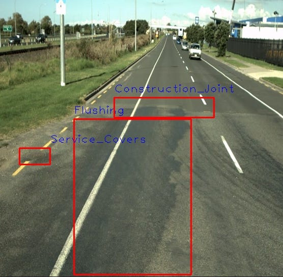
As mentioned in an earlier post, distress identification is conventionally done using subjective visual surveys, often of doubtful accuracy and consistency. Nowadays, video surveys coupled with image recognition allows asset managers to not only use recorded video as a on-demand virtual field inspection tool, but also as a source for more objective and consistent identification of distresses and assets.
Video surveys are relatively inexpensive to conduct. With a $1,000 GoPro camera and a trained student or junior technician, you can conduct a high quality survey, then store your video data in a platform such as JunoViewer1.
Even if you do not pay the additional fee to identify distresses using video imagery and AI, your video data provides an invaluable, on-demand record of each segment on your network. You can use this data to validate decisions and virtually “return”, repeatedly to the same site to validate and re-inform your decisions.
If you do pay the additional fee to identify distresses using video imagery and AI, you get a video record to validate the distress that has been identified. JunoViewer’s AI Image Recognition system (Juno Intelligence, or JI), also allows your team to add distresses not picked up, or to correct any mistakes that the AI system may have made in identifying distress or assets.
I believe that Video Surveys coupled with Image Recognition has the potential to provide some of the most cost effective information on your network. Not only do you get an accurate and objective measure of distress, but you get a video record to which you can return again and again.
If you are already using JunoViewer, then viewing your videos using the Virtual Field Inspection Tool or Network Map tool is included in your annual subscription fee. Lonrix will charge a nominal storage and streaming fee that depends on the total size of videos on your network. For a typical network with approximately 1,000 km of lane length, the annual fee for video storage is likely to be below NZ$2,000 per year.


